Hurricane Lee is emerging as a potentially formidable menace.
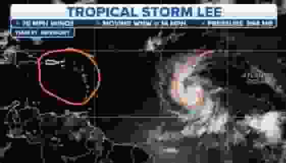
Tuesday afternoon saw the formation of Hurricane Lee, which was initially centered in the tropical Atlantic Ocean with winds of 70 mph. By Wednesday afternoon, the storm had reached Category 1 status.
Hurricane Lee Gains Strength: From Tropical Formation to Category 1 Threat
Lee is moving into a region of the ocean with warm waters and favorable atmospheric conditions, laying the groundwork for rapid and dramatic development in the coming days.
Given the hot sea surface temperatures in the mid to upper 80s, the National Hurricane Center predicts that Lee could become a Category 4 hurricane with winds of up to 150 miles per hour or even a Category 5 storm.
Concerning the path of the cyclone, forecast models have fluctuated. Sunday’s initial forecasts suggested a potential Mid-Atlantic landfall, but Monday’s forecasts shifted to an out-to-sea trajectory.
The trajectory is closer to the East Coast as of Wednesday. The European model (ECMWF) maintains Lee offshore, whereas the American model (GFS) sends it near Cape Cod and into the Canadian Maritimes. Both scenarios require vigilant monitoring.
The ultimate path of Lee is contingent upon the presence and placement of an upper-level depression.
If Lee develops further east, it will likely turn toward the Atlantic. Nonetheless, if it shifts westward, the storm could directly approach the coast, a scenario similar to that of Superstorm Sandy.
Although uncommon, it cannot be ruled out at this time, with late next week as a possible occurrence window.
Read more: Australian Heroes: Three Sailors Rescued From Shark-Bitten Catamaran Off Australia
Hurricanes, Rising Seas, and El Niño’s Surprising Impact

Coastal regions will experience hazardous rip currents, high surf, and beach erosion regardless of whether Lee makes direct landfall.
Recent hurricanes Franklin and Idalia and tropical cyclones Gert, Jose, and Katia have already demonstrated these storms’ disruptive impact on coastal regions.
Higher-than-average sea surface temperatures have distinguished this hurricane season, with multiple locations setting records.
The National Hurricane Center has increased its forecast for named storms this year despite El Nio, which is typically associated with reduced hurricane activity.
The initial prediction of 17 named cyclones has been increased to 21 due to the record warm water temperatures.
Lee is the thirteenth named storm of the year, bringing the season’s total count near average.
Two tropical waves, Margot and Nigel, have the potential to become designated storms in the following week following Hurricane Lee.
Due to the extension of hurricane season until November 30, the Atlantic Basin remains on high alert, highlighting the need for vigilance in the face of ongoing tropical threats.
Read more: Trump’s Bid For Isolation Of Georgia Election Case Amid Co-Defendants’ Push For Speedy Trial