Helene became a major hurricane on Thursday afternoon as part of a rapid intensification (RI) cycle. Maximum sustained wind speeds have climbed by at least 35 miles per hour for the second time since their formation on Tuesday. This means that Helene is on a mission to become another multibillion-dollar calamity.
Helene became a major hurricane on Thursday afternoon as part of a rapid intensification (RI) cycle. Maximum sustained wind speeds have climbed by at least 35 miles per hour for the second time since their formation on Tuesday. During its most recent rapid strengthening phase, it accelerated from an 80-mph low-end Category 1 hurricane on Wednesday to a 130-mph Category 4 cyclone on Thursday.
According to Climate Central’s CSI Ocean index, Helene is moving over waters that are more than 3 degrees Fahrenheit hotter than historical averages, a circumstance that has become 600 times more likely due to climate change. This is the second big storm (Cat 3 or higher) of the 2024 season. 2020-2024 set a record for the most consecutive years (5) in which a significant hurricane landed in the United States.
Hurricane Helene’s wind field is about as vast as it gets. The radius of sustained tropical storm force winds was just under 350 miles Thursday afternoon. According to historical norms, this hurricane exceeds 90% of tropical cyclones.
On Thursday afternoon, a 72-mph wind gust hit Miami’s Opa-Locka airport, 299 miles from Helene. Hurricane-force winds also stretch an abnormally long distance of 60 miles from the eye.
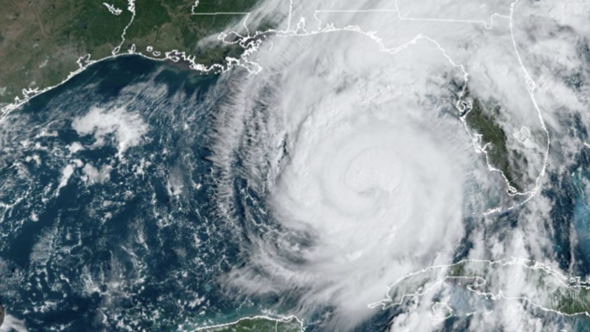
The enormous wind field contributes significantly to the National Hurricane Center’s projection of an “unsurvivable” storm surge. Storm-force winds flow from south to north throughout the eastern Gulf of Mexico. This lengthy wind fetch pushes water toward Florida, with a projected inundation of 8 feet in Tampa Bay and up to 20 feet in Apalachee Bay.
The concave nature of the shoreline between Apalachicola and the mouth of the Suwanee River helps to “collect” all that Gulf water, which will be pushed further higher due to the depth of the ocean bottom. The continental shelf extends far out into the Gulf from the Florida Panhandle. Hence, the waters are shallow in that area. That implies there isn’t much space to “store” the water being pushed towards the coast by the hurricane. The subsequent increase might be huge. If that isn’t enough, there is tremendous fear about how far the devastating winds will extend inland. Helene’s velocity is speeding and will take a long time to slow down. Windstorm devastation could stretch beyond Florida’s capital, Tallahassee, and into Georgia. Helene could bring hurricane-force wind gusts to Atlanta.
Additionally, biblical rains are expected in some Southeastern regions. South and North Carolina could receive 30 inches of rain, resulting in widespread floods and landslides. Aside from the immediate suffering of its victims, the long-term consequences include increased pressure on FEMA and state-level relief agencies, more fuel for a burgeoning insurance crisis, and more reasons to reconsider building or rebuilding in dangerous areas in a century that looks nothing like the past.