In a groundbreaking partnership announced on Wednesday, Google and the Environmental Defense Fund (EDF) have joined forces to address the pressing issue of methane emissions from oil and gas operations.
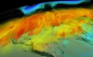
The collaboration aims to leverage advanced satellite technology to detect and monitor sources of climate-warming emissions on a global scale.
Harnessing Satellite Technology to Combat Climate-Warming Emission
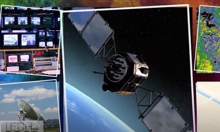
At the forefront of this initiative is MethaneSAT, a state-of-the-art satellite set to launch next month. Developed through a collaboration led by EDF, the New Zealand Space Agency, Harvard University, and other partners, MethaneSAT represents a significant advancement in the monitoring of methane emissions.
Equipped with advanced sensors, the satellite will be capable of pinpointing major sources of methane, an invisible yet potent greenhouse gas, from oil and gas facilities around the world.
Crucially, Google Cloud will provide the computational infrastructure necessary to process the vast amount of data collected by MethaneSAT.
This partnership underscores Google’s commitment to leveraging its technological prowess for environmental conservation efforts.
One of the innovative aspects of this collaboration is Google’s plan to create a comprehensive map of oil and gas infrastructure using artificial intelligence (AI).
By analyzing satellite imagery, Google’s AI algorithms will identify key components such as oil tanks and pipelines.
This map will then be integrated with MethaneSAT’s emissions data, offering insights into which types of equipment are most prone to leaks.
Read more: Saturn’s Subsurface Secrets: Mimas’ Hidden Ocean Revealed
Google Earth Engine Opens Access to Critical Data
The culmination of these efforts will be made accessible through Google Earth Engine, a powerful geospatial analysis platform.
Scheduled for release later this year, this data will be freely available to researchers, nonprofits, and the media. By democratizing access to this information, Google and EDF hope to empower stakeholders with the tools needed to drive informed decision-making and advocate for more stringent environmental regulations.
The launch of MethaneSAT comes at a critical juncture, as governments worldwide are intensifying their efforts to combat methane emissions.
With over 50 major oil and gas operators committing to reducing methane leaks to near-zero levels by the end of the decade, the need for effective monitoring and accountability mechanisms has never been greater.
The United States, in particular, has emerged as one of the leading contributors to methane emissions. In response, the US Environmental Protection Agency (EPA) has proposed mandatory measures to curb leaks from oil and gas operations.
Under a new rule, the public will be empowered to report large methane leaks to federal regulators, underscoring the importance of accessible detection technology.
By harnessing the combined expertise of Google, EDF, and their partners, the MethaneSAT initiative holds the promise of revolutionizing our approach to methane emissions monitoring.
With cutting-edge satellite technology and advanced data analytics, this collaboration represents a significant step forward in the global fight against climate change.
As we strive to build a more sustainable future, partnerships like these serve as a beacon of hope, demonstrating the potential of innovation to address some of our most pressing environmental challenges.
Read more: Oregon’s Human Plague Episode Likely Caused By Pet Cat