A chilling map produced by Climate Central paints a foreboding picture of the United States’ future, indicating that several parts of the country could be submerged by the year 2050 if current climate change-driven sea level rise trends persist.
The map explores the potential consequences of sea level increases at rates of 2mm and 4mm, offering a stark visual representation of the impact on coastal areas, major cities, and crucial ecosystems.
Impacted Coastal Cities
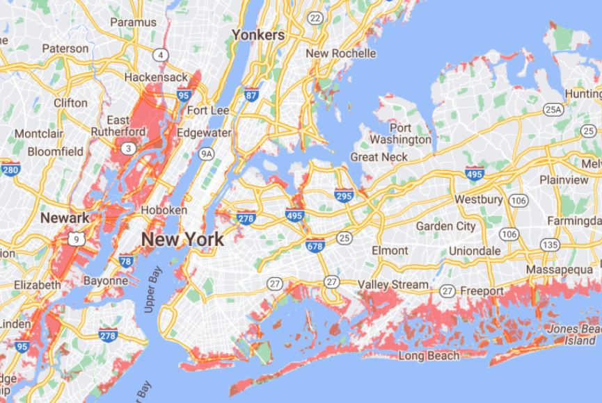
The map highlights the vulnerability of coastal areas to rising sea levels, predicting that many parts of New York and Los Angeles could find themselves underwater in just over 25 years if the current trends persist.
The modeling also identifies neighboring New Jersey as a potential hotspot for the effects of sea level rise, particularly around East Rutherford, where areas could be below the annual flood level by 2050, as indicated by the ominous red shading on the map.
West Coast Vulnerabilities:
The West Coast is not exempt from these dire predictions, with the San Pablo Bay estuary in California facing significant sea level rise that could submerge numerous areas. As coastal regions grapple with the potential impacts, the map serves as a visual warning of the looming threats posed by climate change-induced rising seas.
Impact on Wildlife:
Beyond the human consequences, the map also underscores the profound effects on wildlife. The Everglades National Park in Florida, known for its rich biodiversity, is portrayed as almost entirely engulfed by rising waters. This warning signals potential devastation for countless species and ecosystems, emphasizing the interconnectedness of environmental challenges.
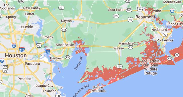
Coastal Communities at Risk:
The map’s predictions extend to the Gulf Coast, sounding an alarm for the coastal area of New Orleans. According to Climate Central, the city’s vulnerability to rising sea levels could have severe repercussions, with smaller communities like Morgan City, home to approximately 11,000 people, potentially facing submersion by 2050.
Urgent Need for Climate Action:
As the map visualizes a future where significant portions of the United States could be underwater within a few decades, it serves as a stark reminder of the urgent need for comprehensive climate action.
The impacts on cities, ecosystems, and communities demand proactive measures to mitigate climate change and adapt to the inevitable challenges ahead.
Read more: COP28 Launches On A Positive Note With Victory For Climate Disaster Fund
Climate Central Map Unveils US Risks from Rising Seas
The Climate Central map paints a sobering picture of the potential consequences of rising sea levels on various parts of the United States.
As policymakers, communities, and individuals grapple with the reality of climate change, the map underscores the critical importance of taking immediate and decisive action to address the root causes and mitigate the impacts of this global crisis.
Read more: Scientists Sound Alarm: Society’s Collapse Within This Century A Real Concern